In this post we are going to tell you everything you need to know if you want to go hiking to discover the Blue puddle. This enclave is located a few kilometers on foot from the ravine and town of The risk in the municipality of Agaete, northwest of Gran Canaria. It is one of the few corners of the island with water all year round.. Furthermore, in times when it has rained a lot, a waterfall falls directly into the Charco Azul and causes the water to advance along the ravine.
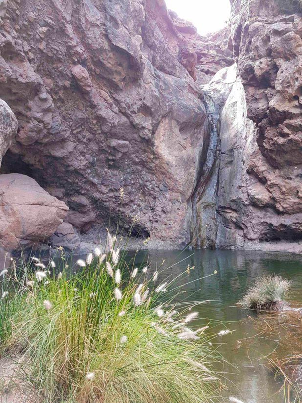
Charco Azul Trail, Agaete
Know that The only way to get to Charco Azul is on foot. Therefore, once you have parked your vehicle, you should go towards the area of houses and bars and ask for the beginning of the trail. Anyway, We leave you the track in case you want to download it, here we explain how to follow it with your cell phone or GPS. Below you also have a brief summary of the route.
| Distance | 3 km |
| Approximate duration | 1 hours |
| Total promotion | 140m |
| Level | Initiation |
| Circular | No |
Then you can download the track if you needed it, although in principle it is signposted. If you do the download from an Android device and you have problems with the file, here you have the solution. In that link we also explain how to follow a track with your cell phone or watch with GPS.
In general, the path is not very difficult, much less if you are used to hiking and sports. Nevertheless, As it is not an approved trail, you should know that if it has rained recently the path can be complicated. We could include this walk within the hiking routes with children in Gran Canaria due to the short distance to travel. However, you should know that there are parts in which you must advance carefully, but it is not along the entire path.
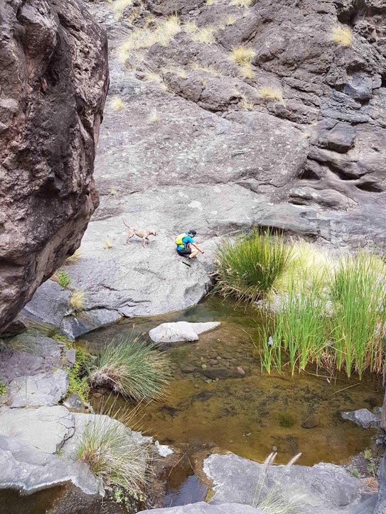
As can be deduced from the previous photo, the channel carries water throughout the ravine. Depending on how much it has rained you may see more or less water, but it always has. The road is quite wide and there is no marked trail. Try to pay attention to where there are more footprints so that you don't have to take big jumps or turn back. Likewise, we recommend that you Before you go, check the weather forecast and prepare your basic hiking kit.
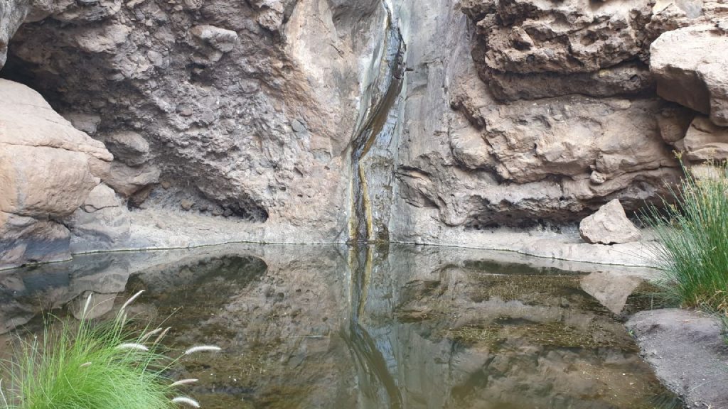
There are people who bathe in the Charco Azul, but we recommend the salt water. Around the corner you can Take a leap to El Risco beach, as it is very close.
How to get to Charco Azul
- If you are in Las Palmas de Gran Canaria, the ideal is that you drive towards Agaete. Once past Agaete, You must continue moving towards the west of the island until you reach the town and ravine of El Risco. You must park there. In total, it is about 55 minutes of driving from the city.
- If you are in the area of Maspalomas, you must drive approximately 1 hour and 20. In the same way, you must head towards Agaete, but El Risco is about 14 kilometers before. When you see a brown sign indicating “El Risco ravine”, you should look for the parking areas seen below.
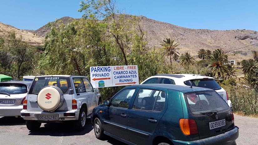
Both car routes are beautiful, although you will have to go through several curved areas. Take it easy. If it is a Sunday or holiday there are usually problems with parking, since it is a very popular excursion for locals. Therefore, as we always recommend, try to go early so you can park easily and enjoy El Charco Azul with peace of mind.
El Risco Beach, Gran Canaria
A few meters by car from Charco Azul we find this virgin beach of callaos (pebbles) and black sand. It is located a few meters from where you parked the car. In any case, the ideal is that you take your car again and leave it in the dirt parking lot next to the sea. The El Risco beach It is very quiet, the problem is that it does not have security or services. Furthermore, youYou have to be VERY CAREFUL with the sea.
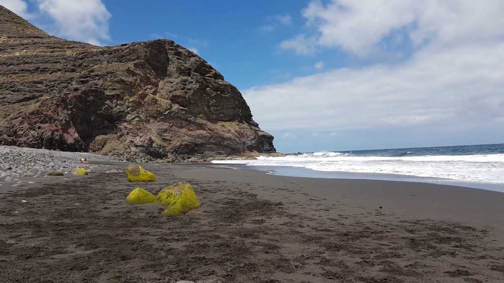
This entire area is located inside of the Tamadaba Natural Park and the Gran Canaria Biosphere Reserve.
Video Charco Azul, Gran Canaria
In the following video you can see part of the path that takes you to El Charco Azul and its waterfall. Is this the first time you read us? If so, take advantage to subscribe to our YouTube channel so you don't miss our videos of Gran Canaria.
Rural houses in El Risco
If you are looking to exile yourself from the world, El Risco de Agaete is a great option. We leave you a link to the rural houses in El Risco so you can take a look.
Podcast Local Guide Gran Canaria
Did you know that we have a podcast that talks about Gran Canaria? Well yes, in chapter 11 we talk specifically about the walk to El Charco Azul, we wanted to share our comments and impressions with you once again. Subscribe on Spotify or iTunes if you don't want to miss the next episode.
That's all folks! If you are organizing your visit to Gran Canaria, leave everything, we have already done it for you. Do not miss it!
We are Ruth & Jorge, Gran Canarian people with a traveling soul. Experts in tourism and digital marketing. We share the most authentic side of Gran Canaria (where we live) and… our adventures around the world!


And this year how is it? Let's go next week
We have been in June 2022 and it is completely dry. I don't know if it's because there is some construction nearby and they are taking the water from there, but there wasn't a drop of water.
Hello Nuria! This year it has rained very little, that must be why... 🙁 what a great shame!!