In this entry we are going to explain to you how to follow a map or track with Guru Maps, a totally free mobile navigation app. As you know, in localguidegrancanaria.com can Download maps of hiking, bike and motorcycle trail routes so you can discover Gran Canaria on your own. These maps are in .gpx format and you can download to your computer or mobile for follow it with a watch with GPS type Garmin, apps like Strava and Guru Maps.
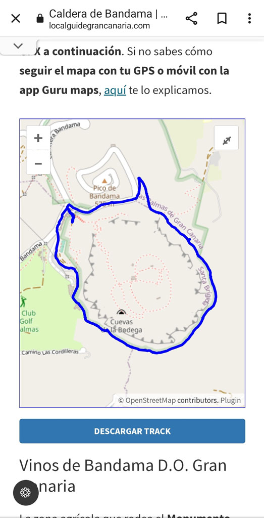
If you would like to follow a track with your mobile There are several forms of Download the maps in .gpx format and follow it with the Guru Maps app. As you know, some of our maps are free and others are paid for. be able to sustain this project.
First step: download track or map .gpx to follow it with your mobile
One of the apps that you can use to follow tracks with your mobile is Guru Maps and it is totally free. If you have Strava, is also another option. In the case of Guru maps, There are a few steps to follow to open the map, depending on whether you download from a computer or mobile device.. At the same time, within mobile devices the guidelines to follow They vary if you have iPhone or Android. Don't worry, we'll clarify it for you below:
Option A) if the .gpx map download is from a smartphone
First of all, go to the Apple Store or Play Store y download the Guru Maps app. Then, If you are going to download the track from your mobile (whether it is a free or paid download), these are the steps to follow:
- Download free tracks from iPhone: if you click to download from your mobile and have a iPhone, the map will be saved in downloads/files and you just have to click open with Guru Maps. It is important that have the app downloaded before trying to open the file.
REMEMBER what it is It is absolutely essential to download the Guru Maps App BEFORE opening the .GPX file.
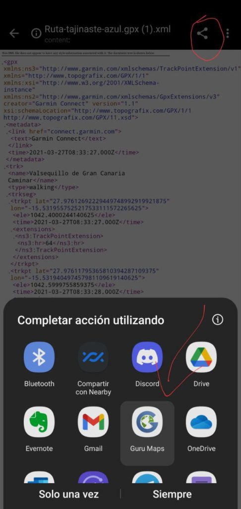

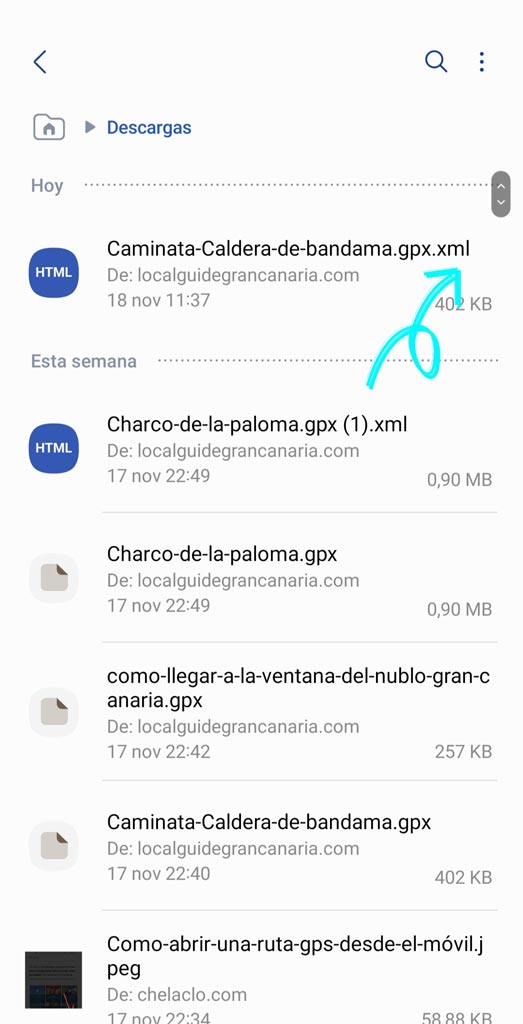
- Download free tracks from Android: If you have a Android device, sometimes the download is saved in the “.xml” format. To open it you just have to rename the file by deleting .xml from the end. That is, if the map is called «circular-caldera-de-bandama.gpx.xml", you have to go to My Files, find the track and edit the file name erasing the end «. Xml«. Once this is done, You open it with Guru maps and that's it. At the end of this article we explain how Guru Maps works.
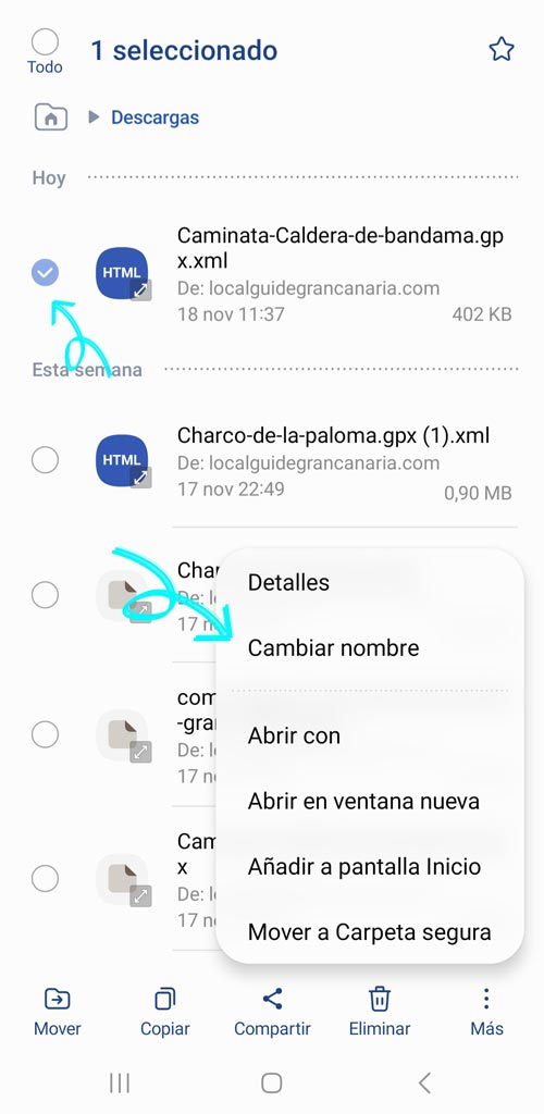
- Payment tracks: if you make the purchase from your mobile, you will receive a email with the map download link. The steps to open the map from Guru maps are the same as we explained before (depending on your operating system).
Option B, if the .gpx map download is from a computer
If the You download it from your computer, the file is downloaded directly in .gpx format and you don't have to change the file name. You will find it in your computer downloads folder. Then You can transfer it to your mobile phone by airDrop, email, WhatsApp or saved Telegram messages (or whatever way you use to transfer files from your computer to your smartphone).

If the download is paid, once the purchase is made, you will receive an email with a download link. Hit download and that's it. Then the step of send it to your mobile device with the method you prefer. In both cases, to follow the map with your mobile the steps are the same. We explain them below in case there are any doubts.
Second step: how to follow a track with Guru Maps gpx format from a smartphone
As we said before, first of all, you must have the Guru Maps app downloaded. On the other hand, once you have the track downloaded in the correct .gpx format on your mobile, you open it with Guru Maps and the map of the trail or path will appear as shown below.
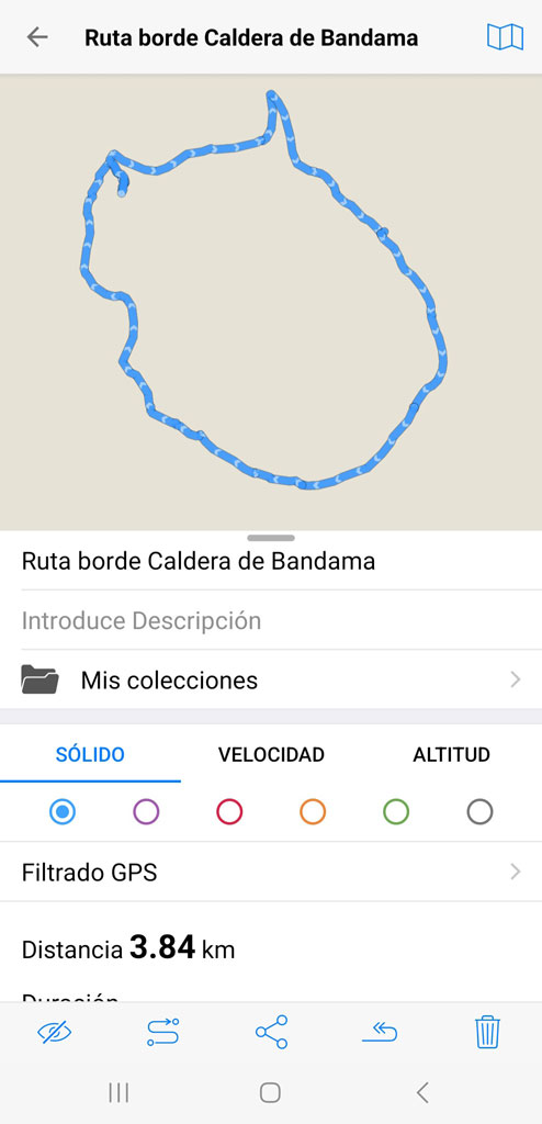
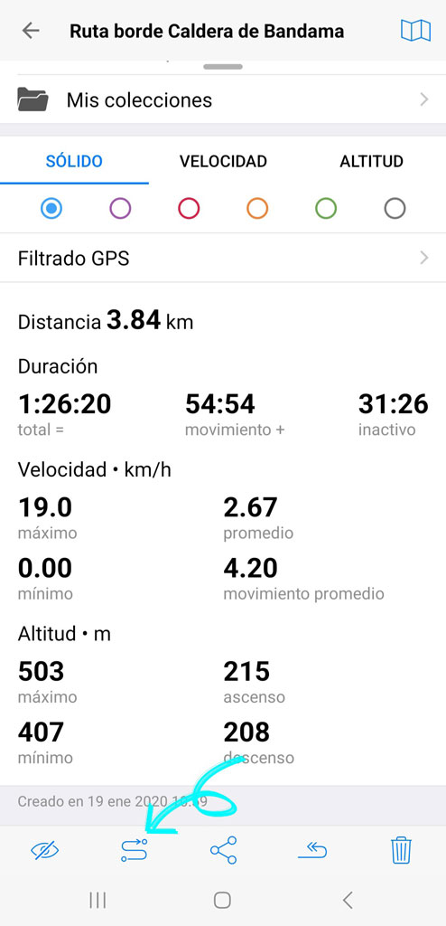
You can scroll to check all the characteristics of the route. Next, To give you directions, you have to click on the icon that we show you with the blue arrow.
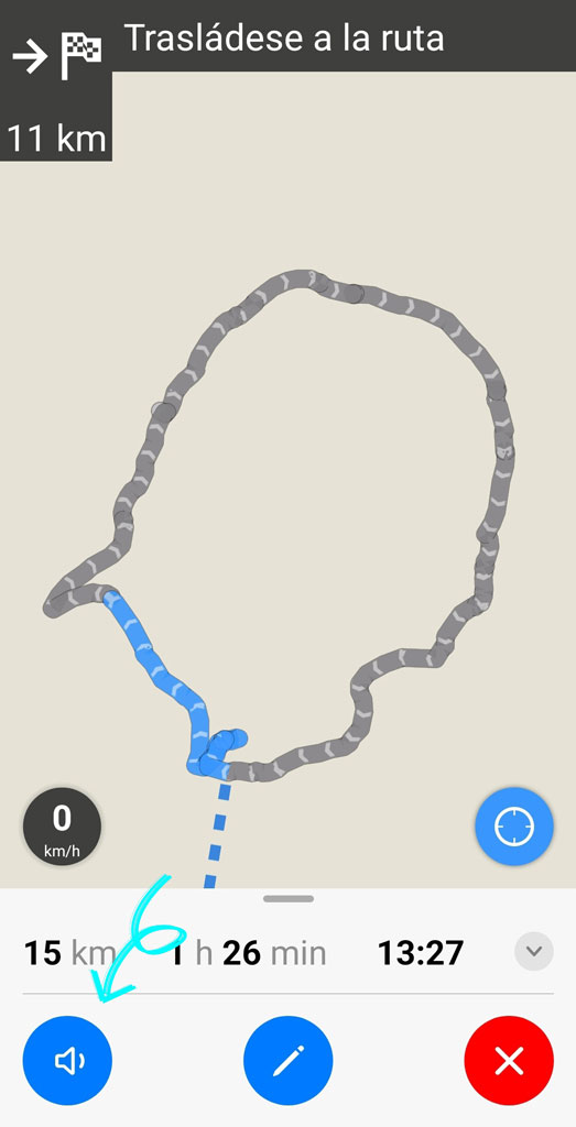
For the GPS to open, you must already be in the area where the trail begins or enlarge the map of the area where the trail is (since your phone will geolocate you to where your device is at that moment). Once you are going to start the trail, you can activate the sound so that it gives you the directions as shown below and so you don't have to walk around with your cell phone in your hand, something that can be dangerous. Also keep in mind that The ideal is that you download the map and do all these tests before going out on the route in case there is no coverage in the area where the trail is..
Important reading for beginners
if you are new in the world of mountaineering, either hiking, cycling routes or even trail bike, the ideal is that Start with simple circular routes that don't get lost, like the one on the Bandama boiler. Additionally, you can download this track 100% free. Once you understand the application well, you can experiment with other routes hiking in Gran Canaria (or another sport) of greater difficulty and where signage is scarcer. In any case, it is always a risk of hiking without experience and individually, so we recommend that you gain experience little by little before launching into the adventure, we don't want you to get lost!
How to upload a gpx track to my Garmin-type GPS?
In this case, the most normal thing will be use the application that we have installed on the computer of the browser device that we have. For example, For Garmin you can upload the tracks from the Garmin Base Camp. The first thing to do is drag the .GPX file to My Collection. In this way we already have the route in the computer application.

The next step is Connect the Garmin to the computer until it appears on the application screen. At that moment we drag the track that we want to transfer to the Garmin navigator over the icon of our device. And ready!

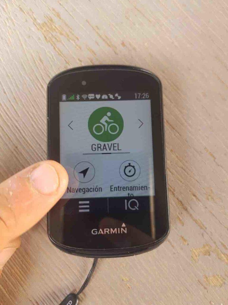
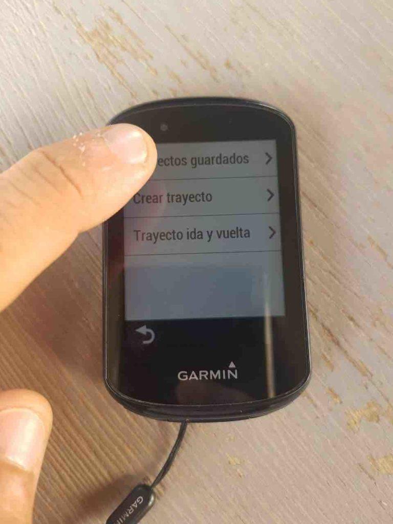
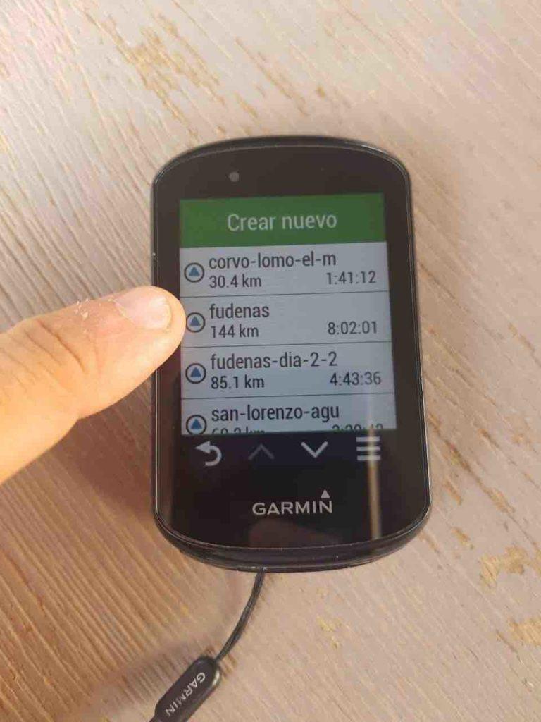
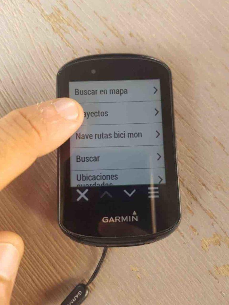
How to follow a track with a Garmin Edge device
Below you have 4 screenshots of how to select a track that we have imported to our Garmin Edge, in the case of the photo it is the model 830. This type of device is very practical for your bike routes in Gran Canaria or even for trail motorcycle routes, since you can attach it to your handlebars.
We believe this article was necessary, as we have had various queries depending on the type of download device, operating system and even navigation system. If you have any questions or issues, please Leave it to us in the comments, since your doubts may be common to other users. Thank you for your support with this exciting project to discover Gran Canaria on your own!
We are Ruth & Jorge, Gran Canarian people with a traveling soul. Experts in tourism and digital marketing. We share the most authentic side of Gran Canaria (where we live) and… our adventures around the world!

