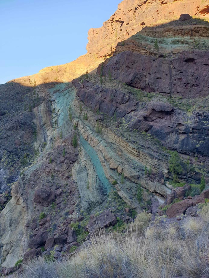
On the road that connects the Puerto de Mogán with The Village of San Nicolás we find the natural and tourist resource Source of Los Azulejos. Is a series of mountains in which we can see different stripes of colors created naturally. This is thanks to the alternation of different types of rocks among which the green clay.
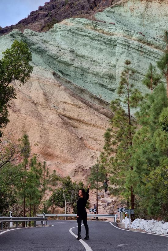
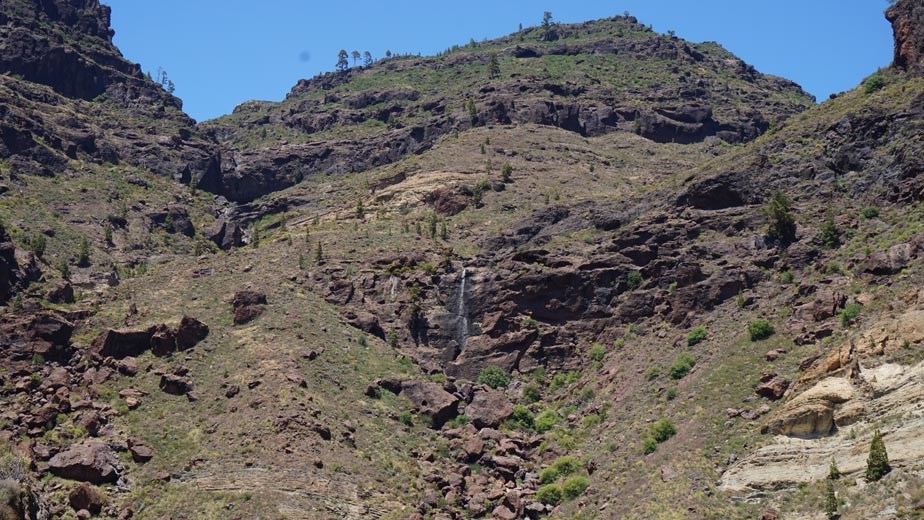
As you surely know, the Canary Islands are of volcanic origin and, therefore, it is not unusual for you to find samples of this type. Nevertheless, This is the area of the Canary Islands where it is best appreciated, as well as where the largest display of colors is found.. Although it rarely rains in this area of Gran Canaria, When heavy rains come, waterfalls are formed that fall from the mountains and are visible from the road.. So you can imagine how spectacular the landscape becomes. What you will be able to see are the marks that the water leaves in its wake as we show you below.
Hiking Source of Los Azulejos and Inagua
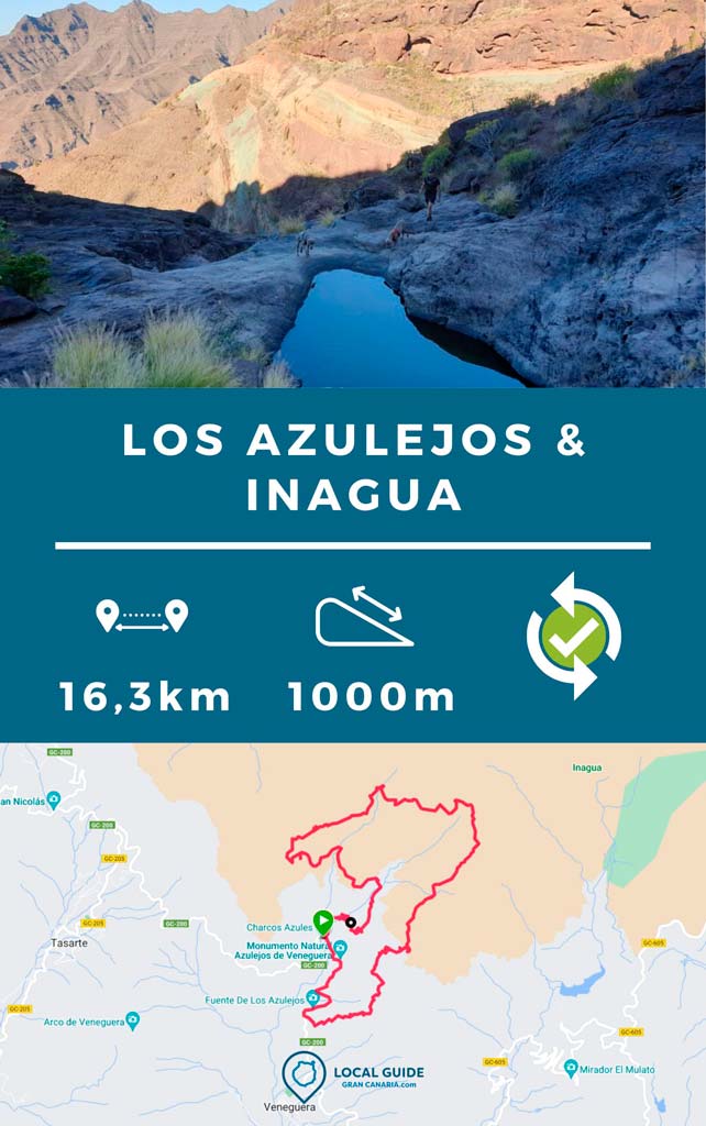
If you like hiking, there is a advanced level circular route of about 16 kilometers that runs Los Azulejos and part of the Inagua Comprehensive Nature Reserve. The views to Los Azulejos, the natural environment, the tranquility during the route and the large puddles after the rains, make this route hiking in Gran Canaria one of the most beautiful on the island.
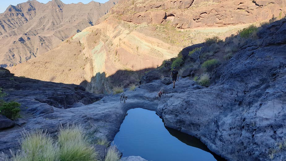
We started the route around 9 in the morning to finish at noon and that's how it was. So we had to leave home very early. As you can see below, it took us almost 16 hours to complete the 6 kilometers with occasional breaks. You can also take it as a day plan and do it in 8 hours. Yes indeed Take enough water and food, there is nowhere to buy along the way. Likewise, if you like running, it is a fairly flat path except for the first hour up and the last hour down.
| Distance | 16,3 km |
| Approximate duration | 6 hours |
| Total promotion | 1.000m |
| Level | Advanced |
| Circular | Yes |
| Picnic zone | No |
Inagua Comprehensive Nature Reserve
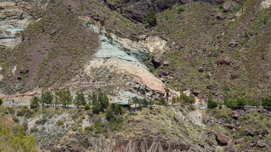
The route that we propose in this article and that we show you in video at the end, in addition to passing through the "colored mountains", runs through some trails of the Inagua Comprehensive Nature Reserve. You should know that This space is the only one on the island that requires administrative authorization to practice hiking.. In addition, you will only be able to circulate on the expressly enabled network of trails. Bikes are prohibited.
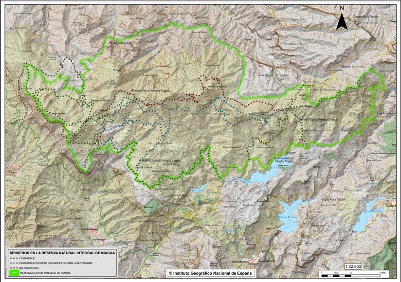
On the other hand, in Inagua lives the blue finch, endemic species of Gran Canaria in danger of extinction. Y, During the breeding season, between April and September, part of the trails are excluded for traffic. In any case, it is a very hot area and it would not be advisable to visit it during the summer months.

Authorization or permission to access Inagua
For request authorization from the Cabildo you can expand information here. If you are going to use the general application form, it is important that in the "Description of the request" you indicate the following:
- Type of activity to perform, that is, Hiking by the Inagua Comprehensive Natural Reserve (C-1).
- Number of people who is going to visit the trail with name, surname and ID of all the members.
- Indicate the scheduled date for the activity (it can be several days)
- Indicate the planned itinerary. Below we detail the areas through which the track passes so that you can detail it:
- Los Azulejos – Barranquillo Salobre (PR Nublo)
- Barranquillo Salobre – Aula Nat. (authorized all year round)
- Nature Classroom – Pino la Hora (authorized from October to March)
- Pino la Hora – Barranquillo Salobre (authorizable from October to March)
This request, regardless of the form of registration, must be registered at least one month in advance to the scheduled date of the visit to the reserve. For any questions that may arise, contact the Environmental Technical Service of the Cabildo de Gran Canaria on telephone 928219229.
How to get to Fuente de Los Azulejos?
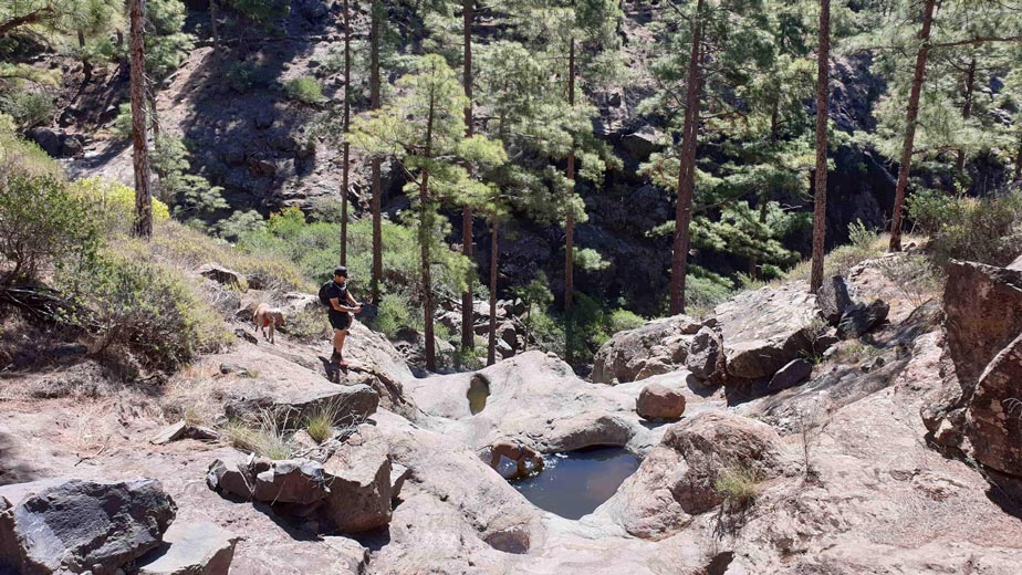
To get to the beginning of the trail, or if you just want to visit the Fuente de Los Azulejos, there is no loss. The mountains can be seen perfectly from the road that connects the Puerto de Mogán with Agaete and vice versa. If you don't plan to do any hiking in the area, The ideal is that the visit to the Fountain of los Azulejos Take it as a stop on the route you take through the west of Gran Canaria. If you are going to do the walk, you should park past the juice stand towards Agaete. There is a wooden sign that marks the beginning of the trail up the mountain.. In any case, if you want to do the same track of the circular route that we did, we give you all the details below.
Track hiking Source of Los Azulejos & Inagua
As we told you, this hiking route passes through Los Azulejos and Inagua and It is of an advanced level, especially in terms of physical fitness, since it is more than 16 km. Likewise, we reiterate that It is only possible to do it from October to March and with prior authorization. If you want to know how to download the track in .gpx format and follow it from your GPS-watch or smartphone, here We explain it to you. On the other hand, if you want to support us so that we continue creating content for you about Gran Canaria, we will appreciate it if you purchase any of our tracks, either to enjoy incredible routes or as a donation. Oh, and don't miss the video we have prepared for you below!
If you only want to see the views and the possible small pool of water, going up and down the same path will be enough, it takes about 40 minutes to go up. Be careful, you must be equipped with appropriate footwear and clothing, since the climb is not easy. We invite you to take a look at our post on the basic hiking kit, some tips may come in handy if you are starting out in this world.
Where to eat near the Fountain Los Azulejos
Just in front of the colorful mountains you will find a beautiful fruit stand and other products from the Canary Islands. There you can order a juice a la carte and purchase other delicacies such as sweets. I hope you are lucky and it happens to be open.
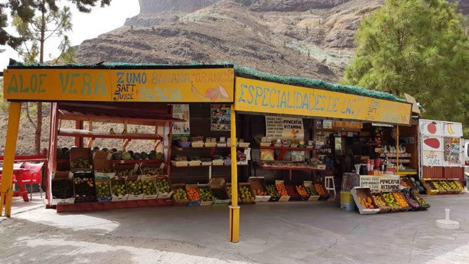
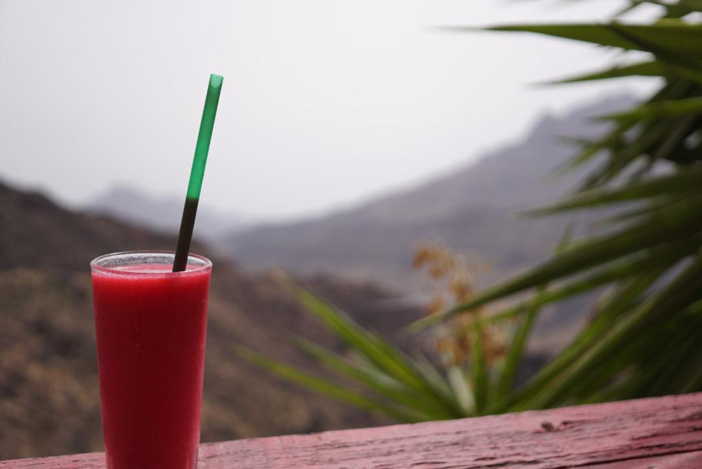
We recommend the papaya juice with orange and Indian prickly pear. Behind the stand there are some curious armchairs for you to enjoy with views of the mountains. Spectacular.
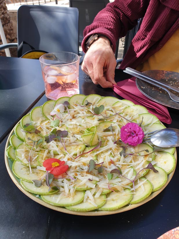
If not, in the town of Veneguera you can also eat at Los Almácicos restaurant by Industria Qulinaria. Try to call and reserve because it is a long journey and there are not many options around. We tell you everything in our article.
Video hiking Source of Los Azulejos & Inagua
Do not miss the video of this route! And, if you want to see more videos like this to discover the most authentic side of Gran Canaria on your own,subscribe to our channel here!
Podcast Episode 22: Los Azulejos
If you are bored with so much text and prefer to listen to everything you need to know about this site and the hiking route, we invite you to listen to the episode dedicated to the Fountain of Los Azulejos from our podcast.
Gran Canaria Guides
Do you want to discover more sites like this? And what places do we frequent to eat? All the details in our Gran Canaria guides.
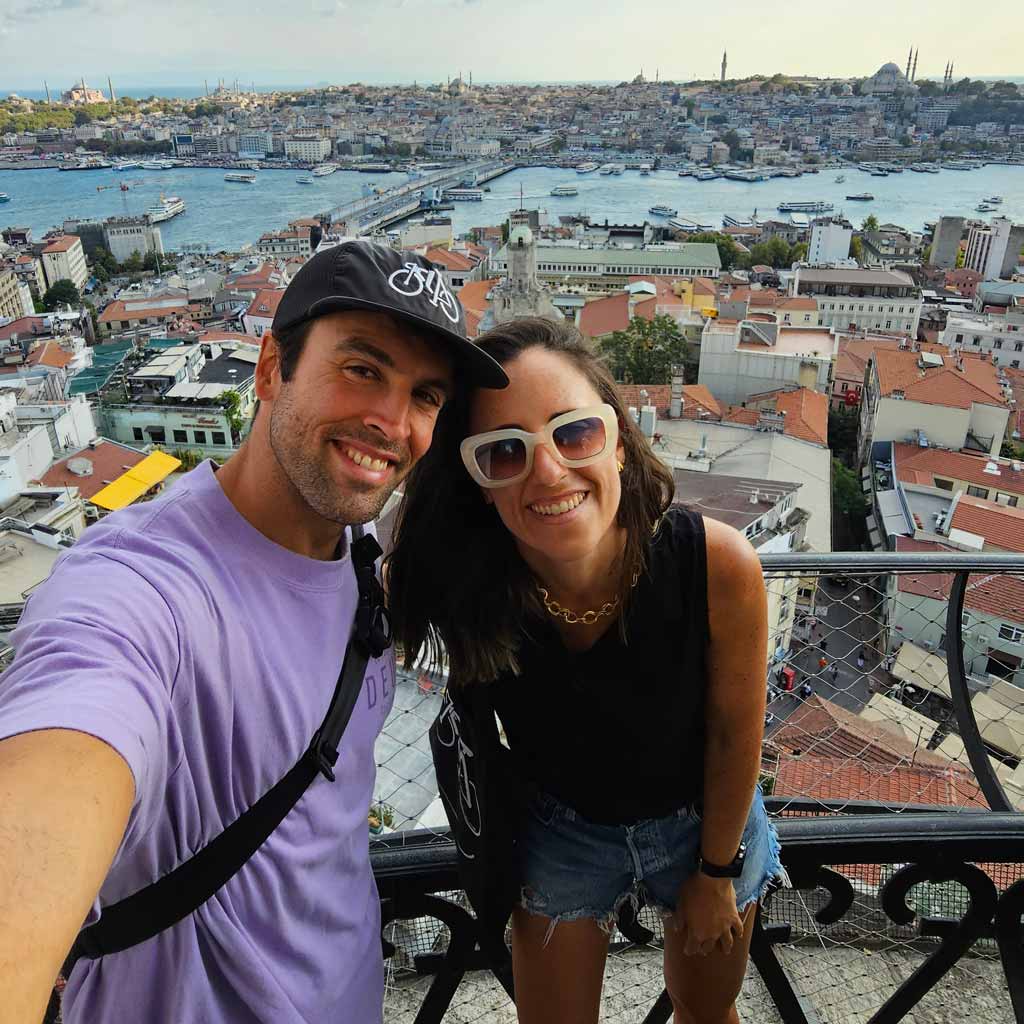
We are Ruth & Jorge, Gran Canarian people with a traveling soul. Experts in tourism and digital marketing. We share the most authentic side of Gran Canaria (where we live) and… our adventures around the world!


Hello, to visit only the source, is permission also necessary? Thank you so much!
Hello Hayleen! To climb the first part of the trail with views of all the colorful mountains or Azulejos it is not necessary to ask for permission. If you want to access the Inagua Comprehensive Natural Reserve, yes, as we indicate in this article. By the way, there is no water all year round, I say this more than anything because your question is about visiting "the fountain" and possibly at this time of year there is no water left. We hope we have helped you.
a greeting
Hi! I have just bought the track but the format that I received after downloading was xml and not gpx.
Garmin doesn't accept xml files. Can you tell me how I can get the gpx?
Thank you
Hi Selma! I guess that you have purchased the track from your smartphone. Sometimes (we don't know why), the file is downloaded in .xml format, but you just have to edit the name of the file deleting the .xml from the end and that's it. Here we explain it:
https://localguidegrancanaria.com/en/how-to-download-and-follow-a-track-with-smartphone-or-navigator/
Enjoy the trail and remember to ask for the permit!
Cheers!
Hello, could this route that I see that passes through the San Antonio Cross along the forest track be done by bike? Without taking the tour of los azulejos where do they go up, thank you very much prop
Good morning Octavio! From what we understand, it is prohibited to go through Comprehensive Natural Reserves and Inagua is... It is a shame, especially since it is a clue. We also tell you that we know of people who go there 😉
I would like to follow this route, because I love the mountains and what you publish is worth seeing, but I get that I have to pay to download them, does this work like that?
Hello Montse! Yes, it is a small price for the work, time and dedication. It is the only way projects like this can survive 🙂 We believe that €1,99 is a fair price for all the valuable content that we share for free 🙂 Thank you for your interest too, greetings!
Hello! I would like to take this tour, but I can't download the information. Would it be possible for you to send it to me? Thank you!!!
Hello Leire!! Thank you for your interest in this route! In order to download the map in .GPX format and do the route on your own, you have to click on the "buy this track" button. This will take you to a payment gateway. Once payment is made, you will receive an email with the download link 🙂 Greetings! 🙂
I can't download the map, could you send it to me by email?
Good morning Adam! It should be downloadable under the map using the “download” button. The file format is GPX. Anyway, we just sent it to you by email 🙂 check your spam folder in case it arrives there. Enjoy it! All the best!
On a route as beautiful as that, saying “the best thing, of course, is not to meet anyone” is actually something to think about. Nor that people were predatory animals that were going to attack them. It is one thing to appreciate solitude and quite another to highlight the absence of people as the best thing.
Hello Sandra!! I imagine you are referring to a comment we make in the video. This is an improvised and informal comment. Don't take us at our word. Our intention will never be to belittle the beauty of Gran Canaria, nor to mess with its inhabitants/visitors. We just wanted to point out the absence of people. As you may know, on some hiking routes there is a certain saturation, since the volume of people accessing natural spaces is not controlled. Therefore, this degrades the environment, as well as losing the charm when visiting the spaces. I hope that with this clarification you don't continue to believe that we don't like people hehe Greetings
Hello, good morning, could you send me a link where I can follow the route in real time.
Greetings ..
Hello Juanma! Below the map there is a button that says "Download" there you can download the complete map with the entire circular route to follow it on your own. You must have the Guru Maps App installed. Here we'll explain to you how to do it We cannot share it in real time, we would have to be doing the route at the same time to follow it in real time hehe, greetings and enjoy.
I would like to take the route but I can't download the information. Could you send it to me?
Hello Beatriz, I sent you an email with the track so you can follow it from a Garmin-type GPS or from your smartphone with the Guru Maps app.
Greetings and what pleases you.
Ruth
incredible route
I would like to do it, but I can't download the log. Would it be possible to upload it to wikiloc?
Hi Javier!! The truth is that yes, we recommend it. We have changed the link, try now and tell us! A hug!