
El Barranco de Los Cernícalos is one of the most beautiful and, therefore, visited by residents in Gran Canaria. In this ravine, water flows 365 days a year and, let's hope it continues like this for a long time! Below we will give you the details to take into account if you want to do this route. hiking in Gran Canaria.
The bed of the Los Cernicalos ravine is located in the Special Natural Reserve of Los Marteles (Valsequillo) and also within the Protected Landscape of Lomo Magullo in Telde. That is, the ravine runs through part of the two municipalities.
Here you will find one of the largest canary willow forests in the archipelago. At the same time, more than half of the flora that lives here is endemic and 10% of it is exclusive to Gran Canaria.
Route and track characteristics
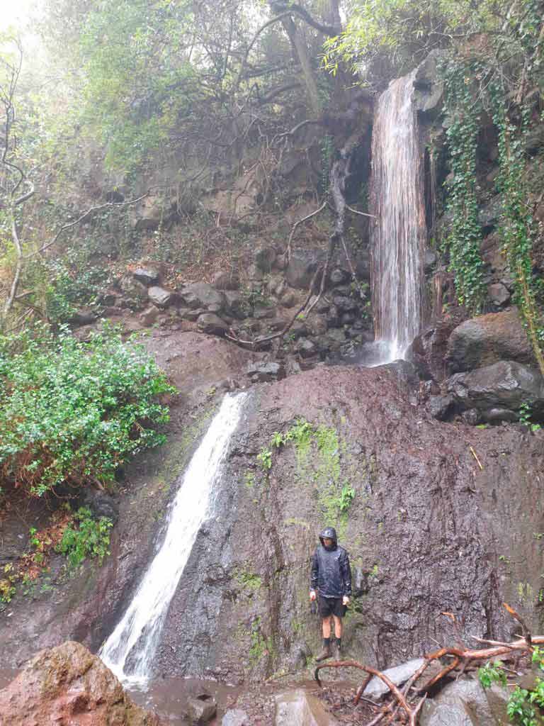
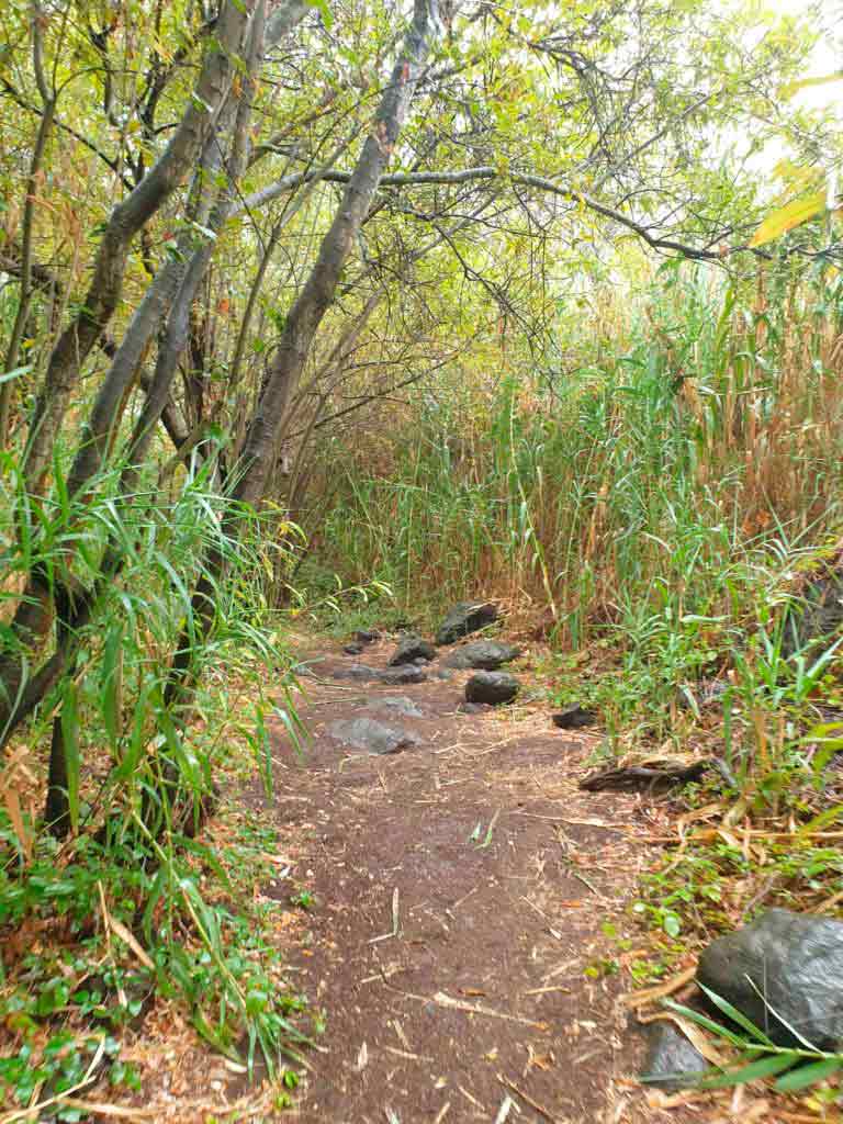
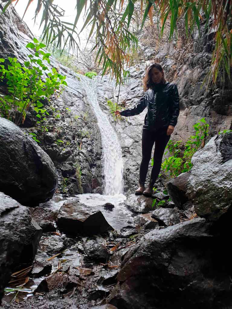
It stands out for being one of the most beautiful in Gran Canaria, as it has a stream that carries water all year round, as well as several waterfalls of different sizes. We can categorize the path easy and therefore, one of the routes to do hiking with children in Gran Canaria. This is so since 90% of the route is flat and without major dangers. This does not mean that you have to keep an eye on the little ones, as there are some climbs and areas of gorges where you will have to cling to rocks and/or branches. At the same time, It is important to wear appropriate footwear to avoid slipping.

The duration of the route through the Barranco de Los Cernícalos is approximately 7 kilometers round trip. It is not a circular route, that is, you have to go and return through the same place. Regarding the duration of the trail, depending on the pace you take and if you go with children, it may take 2 to 3 hours to the last waterfall. We take to long 2 hours and 20 to the last waterfall (including the return), making stops to record and take photos. Below we leave you a small summary.
| Distance | 7,3 km |
| Approximate duration | 2 hour and 30 |
| Total promotion | 328m |
| Level | Initiation |
| Circular | No |
| Picnic zone | Yes |
Then you can download the track if you needed it, although in principle it is signposted. If you do the download from an Android device and you have problems with the file, here you have the solution. In that link we also explain how to follow a track with your cell phone or watch with GPS.
How to get to the Los Cernícalos ravine
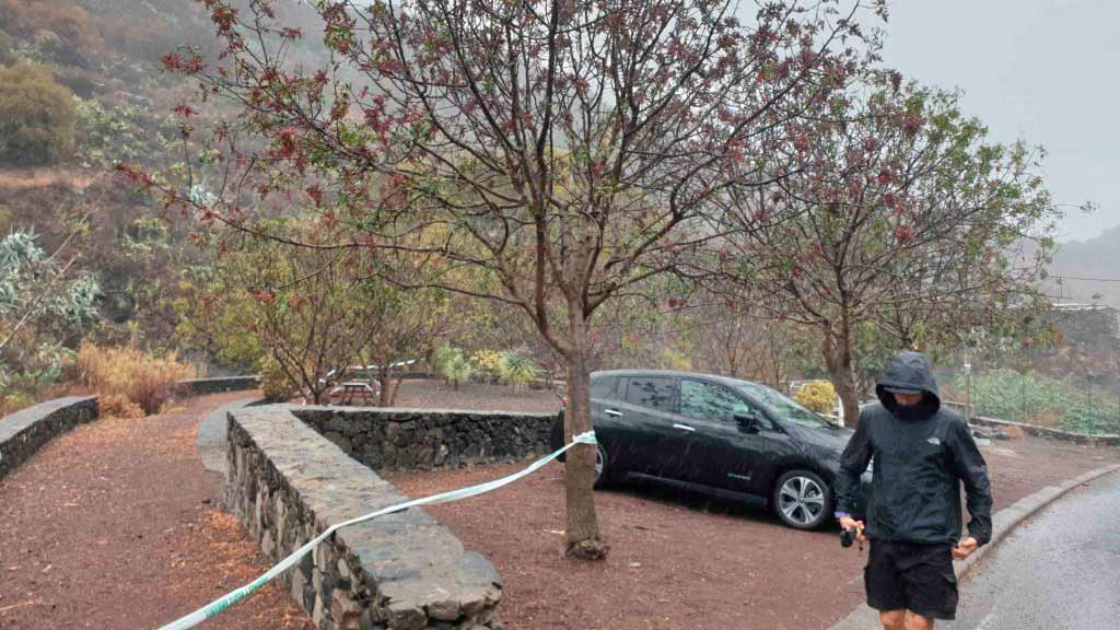
To get to the Barranco de Los Cernícalos, we recommend that you enter the name Los Cernícalos Ravine Picnic Area on your GPS. The GPS or Google maps will take you to the picnic areas or recreational areas before the start of the route. This recreational area is called Los Arenales. Here you can park your car, since the beginning of the trail is just a few steps away. You just have to follow the car path on foot until you come across some signs indicating "waterfalls." It's over there.
You don't need to look for the route on Wikiloc, everything is marked and you will hardly be able to get off the trail. Yes indeed, Keep an eye out for detours along the route to see all the waterfalls. This is the first and it is somewhat hidden.
Tips to make your visit to Los Cernícalos a success
✔ Try to avoid weekends and holidays, since there is a lot of local tourism that visits it.
✔ Go as soon as possible. If you can't avoid Saturdays, Sundays and holidays, go early. The trail loses all its charm when there are many people and, unfortunately, there is no control of the number of people who can visit it in a day.
✔ Wear appropriate shoes and clothing, the trail is easy, but there are areas where it can be dangerous. We invite you to take a look at our article mentioning the essentials for a hiking kit property.
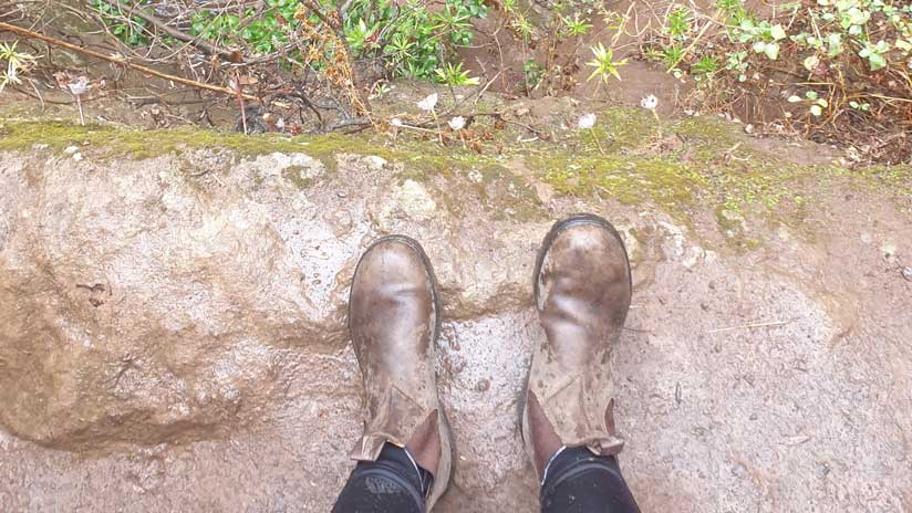
✔ Try going on a rainy day (like us). The landscape looks twice as beautiful and you will avoid too many crowds. Then, Bring a good raincoat and boots, as well as dry clothes to change into when you finish.
✔ Bring water and food to be able to make a stop, especially if you go with children. There is nowhere to buy water or food in the area.

Restaurants in Valsequillo
As we show you in the following video, we recommend that you take advantage of the route to go up to the town of Valsequillo to eat. We love the Sons of Ortega Grill (formerly Restaurante Monzón or Ca' Eusebito), the Casa Brito Grill and Guachinche Viña Cantera.

Video of the walking route through the Los Cernícalos ravine
We leave you with a route video, We hope you enjoy it as much as we do. If you don't want to miss more videos about Gran Canaria, Subscribe to our YouTube channel.
Do you want to know the most authentic side of Gran Canaria on your own? Take a look at our guides!


We are Ruth & Jorge, Gran Canarian people with a traveling soul. Experts in tourism and digital marketing. We share the most authentic side of Gran Canaria (where we live) and… our adventures around the world!

Thank you very much, I take your idea and information; I think I'll do the route when I go in October. Please, correct that "overcoat", which makes a bit of a mess at sight 🙂 A hug.
made!!!!!!! Enjoy it 🙂 A hug Miguel!
First of all, thank you for all the information you provide to enjoy the Island as much as possible. I have done five routes in a week based on your suggestions and instructions.
I would like to clarify that regarding this route (which I loved) that to get there I put “barranco de los kestrels” in the Google Maps search engine and where I am trying to take us (on somewhat dodgy roads) does not correspond to the beginning of the route. It must be the closest road to any indication that Google has of the ravine. On the other hand, if you put "Merededero del Barranco de los Kestrels" in the Google search engine, it will leave you in the right place to start the route.
I loved the route.
I reiterate my gratitude.
Hello Pedro!! Thank you very much for your comment! It helps us to know that what we do is useful for someone 🙂 Thank you also for the geolocation point 🙂 A hug!