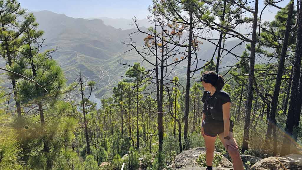
• Skip to primary navigation
  • Skip to main content
  • Skip to footer
LOCAL GUIDE GRAN CANARIA

LOCAL GUIDE GRAN CANARIA

Todo sobre Gran Canaria / Everything about Gran Canaria

  • THINGS TO DO
    • ACTIVITIES
      • BOAT HIRE
      • DIVING & SNORKEL
      • KAYAKING
      • SURFING
    • EXCURSIONS
    • LAS PALMAS DE GC CITY
    • BEACHES
    • VILLAGES
    • LEISURE
    • SHOPPING
  • PLACES TO EAT
    • LOCAL FOOD
    • SPANISH FOOD
    • BREAKFAST
    • PREMIUM RESTAURANTS
    • HEALTHY FOOD
    • INTERNATIONAL
  • TRAVEL GUIDES
    • CUSTOMIZED GUIDE
    • FULL GUIDE
    • GRAN CANARIA / 7-14 DAYS
    • GRAN CANARIA / 2-5 DAYS
    • RESTAURANTS
    • BEACHES
    • STAG DO / HEN PARTY
  • ROUTES
    • HIKING
    • TRAIL RUNNING
    • BIKE ROUTES
      • ENDURO TRACKS
      • GRAVEL & MTB TRACKS
      • LAS PALMAS BY BIKE TRACK
    • MOTORBIKE
  • STAY
    • CITY HOTELS
    • FAMILY HOTELS
    • ADULTS ONLY
    • 5-STAR HOTLES
    • 4-STAR HOTELS
    • RURAL HOTELS
    • RURAL HOUSES
    • CAVE HOUSES
    • VILLAS
    • PET-FRIENDLY
  • BLOG & INFO
    • BLOG
    • DISCOUNTS
      • 5% TRAVEL INSURANCE
      • 5% FERRIES
    • TIPS
    • TRANSPORT
      • HIRE A CAR
      • AIRPORT TRANSFER
      • GET AROUND GRAN CANARIA
      • VISIT ANOTHER ISLAND
    • VIDEOS
  • + DESTINATIONS
    • CANADA
    • COSTA RICA
    • ISRAEL AND JORDAN
    • JAPAN
    • ROUTE 66
    • NEW YORK
    • CANARY ISLANDS
      • EL HIERRO
      • TENERIFE
    • BELGIUM
    • SENEGAL
  • Español

Trail running in Gran Canaria, the best trails!

In this section we would like to share with you the most beautiful trail routes in Gran Canaria so that you can enjoy running in the mountains while discovering the island. They are really intermediate and advanced hiking trails in Gran Canaria that are perfectly suitable for trail running.

trail gran canaria

Best trails for running in Gran Canaria

Of the trail running routes in Gran Canaria that we have done, we will tell you about the ones that we think are the most beautiful and spectacular to discover the island. The network of trails on the island is super extensive and, as we do more, we will post them here. In our English newsletter we will be sharing all the routes and places to visit in Gran Canaria in case you want to sign up. Here are our top 4 trail routes in Gran Canaria. Below you have them all 🙂

discount iati insurance local guide gran canaria

1) Circular Montaña Alta-Monte Pavón

This route through Monte Pavón is one of the greenest on the island and one of the most recommended in winter so that you can teleport yourself to the Ireland of Gran Canaria. Along the trail you will find a diverse landscape of meadows, flocks of sheep, Canarian pine forests, traditional cheese dairies, among others.

Both before and after the route you can take advantage of the fact that you are in the area to visit the Casa del Queso and go up to the viewpoint of Montaña Alta. If you want to do it, click on the name of the route above for more details.

Distance13,4 km
Estimated duration3-4 hours
Total ascent671 m
CircularYes
En-route provisioningNo

2) Circular Firgas-Azuaje ravine

This circular route leaves the village of Firgas and runs through one of the ravines that carries water all year round, the Azuaje ravine. So you can imagine its greenery. It leaves from the village of Firgas and passes a spectacular viewpoint overlooking the ravine that reminds me of Jurassic Park (obviously without the dinosaurs hehe).

Trail in Gran Canaria, Azuaje ravine

Note that there are certain parts of the route where you will have to climb with ropes on two specific steps, nothing that you can’t do if you are an agile person. This is something we understand if you are a trail runner. While you’re in the area, we recommend you take a look at our article on places to visit in Firgas. Here is a brief summary of this trail suitable for trail running.

Distance9,4 km
Estimated duration2-3 h
Total ascent533 m
CircularYes
En-route provisioningNo

3) Circular Puerto de Las Nieves – Agaete Valley – Berbique

This route has become one of our favorites because of the views it offers for a large part of the trail over the entire Agaete Valley and the north coast of Gran Canaria. The highest point is the Era de Berbique at 635 metres, which is also beautiful. In fact, the surrounding mountains are reminiscent of Yosemite in the United States.

Gran Canaria trail running, Agaete

On the other hand, on the way down you will have views of the rugged coastline known as the “dragon’s tail” and of Tenerife (on clear days). Moreover, as it is a circular route, it starts and ends at Puerto de Las Nieves, one of the most famous places to visit in Gran Canaria.

Distance16,5 km
Estimated duration4-6 hours
Total ascent777 m
CircularYes
En-route provisioningNo

4) Three dams route

We loved this route through the Three dams of Gran Canaria, which starts in Chira and passes through Las Niñas and Soria. It also passes through the Soria ravine, one of the most beautiful places on the island. If you do it after the rainy months you will also see a lot of water as small waterfalls and, if you are lucky, the dams are full! Below you can see the technical details, especially the total ascent.

Distance17,5 km
Estimated duration (running/hiking)4-7 hours
Total ascent1.237 m
CircularYes
En-route provisioningYes, but at the 10 km

5) Way of St James of Gran Canaria

I don’t know if you knew that there is a Way of St James in Gran Canaria. If not, you already know it. In case you are looking for a long trail running route of medium-high difficulty, this is the best option. The trail has a total of 66 kilometres and is usually divided into three stages of different lengths and gradients. We recommend that you read the article with all the detailed information by stage, as it requires some organisation as it is not a circular route.

Way of St James of Gran Canaria for trail running

Gran Canaria trail running routes by season

On the other hand, there are other trail running routes in Gran Canaria whose beauty is highlighted during certain times of the year or which are only accessible at certain times of the year. These are the following:

  • Circular Tajinaste Azul in Valsequillo with the tajinaste in flower from February to April approximately.
  • Circular of Charco de La Paloma hike in Tejeda with the almond tree in blossom from January to March normally
  • Fuente de Los Azulejos by the Inagua Nature Reserve, only accessible with a permit from October to May. The rest of the months it is forbidden because it coincides with the breeding season of the blue chaffinch, an endemic species of Gran Canaria in danger of extinction.
Blue tajinaste in Gran Canaria

Finally, there are also other easy routes on the plain that we recommend for those who are just starting out on trail routes. This is the case of the Los Giles circular route with views of Las Palmas de Gran Canaria.

How to get to Güigüi beach and important tips

playa de guigui

Nowadays there are few unspoilt beaches left in Gran Canaria, and Güigüi beach is one of them. This is due to its difficult access, making it an earthly paradise where…

Three Dams route in Gran Canaria: Chira, Las Niñas and Soria

Ruta de las Tres Presas Gran Canaria

The Three Dams route in Gran Canaria (Tres Presas) is undoubtedly one of the most spectacular hiking routes in Gran Canaria. This hike, which is still little known, passes through…

Trail running in Los Giles with a view to Las Palmas de Gran Canaria

Panorámica Las Palmas de Gran Canaria

If you are looking for trail running in Las Palmas de Gran Canaria, you are going to love this route through in Los Giles. It is ideal for those who…

Way of St. James of Gran Canaria, info of each stage & tips

The Way of St James of Gran Canaria (Camino de Santiago de Gran Canaria) is one of the hardest and most beautiful hiking routes and challenges in Gran Canaria. It…

Charco de La Paloma. The waterfall that is trending on instagram

The Charco de La Paloma hike or Charco de Las Palomas is a trendy trail in the municipality of Tejeda, in the interior of Gran Canaria. Specifically, it is about…

Hiking in Teror. The hike of El Álamo and the vertigo stairs

senderismo en teror

In this post we want to tell you about a new hiking route in Teror: El Álamo hike, known for its wooden stairs. It is a new path that has…

Circular Agaete Valley from Puerto de Las Nieves

Era de Berbique, ruta circular Puerto de Las Nieves- Valle de Agaete

In this article we would like to share with you a circular hiking route through the Agaete Valley that starts and ends in Puerto de Las Nieves, in the north…

Hiking in Azuaje Ravine, one of the most beautiful

The Azuaje ravine is located in the north of Gran Canaria and forms the geographical border of the municipalities of Firgas (70%) and Moya (30%). The Azuaje Special Nature Reserve…

Hiking in Tamadaba Natural Park, nature in its best

Mirador de Llanos de La Mimbre

Tamadaba is a Natural Park of Gran Canaria located in the northwest of the island. Specifically, it takes part of the municipalities of Artenara, La Aldea de San Nicolás and…

Montaña Alta and Mount Pavón. Entre Cortijos hike

On this occasion we want to share with you a circular hiking route known as Entre Cortijos (between farmhouses). It starts in Montaña Alta and passes through Mount Pavón, in…

Tajinaste Azul route, hiking in Valsequillo

tajinaste azul gran canaria

This time we want to share with you a hiking route through the municipality of Valsequillo: the Tajinaste Azul hike. It is a circular route that runs along two of…

Guayadeque: things to do & local food in caves

barranco de guayadeque

Guayadeque is a spectacular ravine located east of Gran Canaria. It is one of the longest ravines in the Canary Islands and divides the municipalities of Ingenio and Agüimes. It…

Places to run in Las Palmas. 4 ways to discover the city

Parque Romano

Would you like to know the best places to run in Las Palmas de Gran Canaria? Whether on vacation or a few days for work, there are no excuses. Also,…

Hiking in Los Tilos de Moya

Sendero Los Tilos de Moya

The Tilos de Moya hike is one of the easiest and most beautiful to do in Gran Canaria. In the same way, if you are starting to do hikes in…

Hiking in Cruz de Tejeda, the heart of Gran Canaria

Cruz de Tejeda

Hiking in Cruz de Tejeda is a must for nature lovers! Cruz de Tejeda. Cruz de Tejeda is a well-known meeting point and a pleasant place to make a break…

San Felipe: hiking through the Royal Route of the North & local surf

cuevas del camino

The San Felipe beach and its coastal town belong to the municipality of Santa María de Guía, in the north of the island of Gran Canaria. Its coast is a…

We hope that some of these trail running routes in Gran Canaria will help you to train and get to know the island at the same time. Remember that all these trails can also be done walking. And, if you like to compete in trail running races, every year there is a well-known mountain race in Gran Canaria, the Transgrancanaria. It has different modalities, the longest being 128 kilometres and the shortest 13 kilometres. We invite you to do a little research so that you can choose the distance that best suits you.

First time Trail Running in Gran Canaria

  • Weather forecast. It is important to check the weather forecast for the area through which the route passes. The island has different microclimates, and past a certain altitude there can be freezing temperatures in winter and it is advisable to take warm clothing. The same goes for the other way around, if you are going to run in a hot area, take sun protection cream, as well as sunscreen for your head.
  • Provisioning. During many routes there are no shops to buy food or drinks because you are in the middle of nature. Take enough food and drink for any unforeseen eventuality.
  • Goretex trainers. There are areas in the interior of Gran Canaria that are very wet and muddy, we recommend shoes with Goretex (waterproof material) for routes on rainy days or after rainy days.
  • How to follow a track. If you have never done trail running or hiking outside your home area, here’s how to follow a track with your mobile phone or navigator.
Montañón Negro during the trail route through Monte Pavón

Guides to Gran Canaria

Finally, if you want to discover more places on the island without having to worry about what to visit or where to eat, you can save time in planning with our Gran Canaria guides. They’re all just a click away below.

guides to gran canaria
Guides to Gran Canaria

Footer

Legal disclaimer and contact:

  • Contact
  • Cookies policy
  • Privacy policy
  • Terms & conditions

Follow us:

  • youtube
  • tiktok
  • instagram
  • facebook

Newsletter Telegram:

  • telegram

Subscribe to our epic newsletter:

We do not send spam. Read here our privacy policy.

Check your inbox or spam folder to confirm your subscription to our newsletter and start receiving our news about Gran Canaria :)

Copyright © 2023 · Local Guide Gran Canaria · All rights reserved.

We use cookies to offer you the best experience on our website. You can read more about the cookies we use or disable them in the settings.


Privacy policy

This website uses cookies so that we can offer you the best possible user experience. Cookie information is stored in your browser and performs functions such as recognizing you when you return to our website or helping our team understand which sections of the website you find most interesting and useful.

You can check here our privacy policy and cookies policy.

Strictly necessary cookies

Strictly Necessary Cookies must always be enabled so that we can save your cookie setting preferences.

These cookies are:

User Log in

Cookie acceptance

Comments

Security

If you disable this cookie we will not be able to save your preferences. This means that every time you visit this website you will have to activate or deactivate cookies again.

Third party cookies or analytics

This website uses Google Analytics and Facebook Pixel to collect anonymous information such as the number of visitors to the site, or the most popular pages.

Leaving this cookie active allows us to improve our website.

Please enable strictly necessary cookies first so we can save your preferences!

Additional cookies or advertising

This website uses the following additional cookies:

Google AdSense

Please enable strictly necessary cookies first so we can save your preferences!

Cookies policy

More information about our privacy policy and cookie policy.