
The circular of the Three Dams in Gran Canaria It is undoubtedly one of the most spectacular hiking trails in Gran Canaria. This path, still little known, passes through the Chira, Las Niñas and Soria dams. Of this route of the dams we highlight the unique beauty of the Soria ravine, as well as the different landscapes of Canarian pine forest and palm grove. On the other hand, you will see the different shapes that the rocks have along the entire path. We tell you everything below!

Route of the Three Dams of Gran Canaria: Chira, Las Niñas and Soria
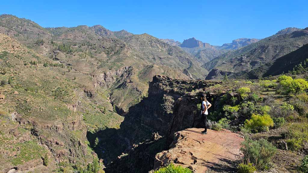
The island has a total of 69 large dams. That is, hydraulic works to retain water from ravines more than 15 meters high or more than 100.000m3 in capacity. In case you didn't know, the presence of such amount of prey in such a small space makes Gran Canaria a unique case in the world. Throughout the Three Dams route you will pass by the Chira dam, the Las Niñas dam and that of Soria. The track starts from the Chira dam, biggest prey of the Canary Islands in terms of volume and depth. However, since it is circular, you can choose the starting point.
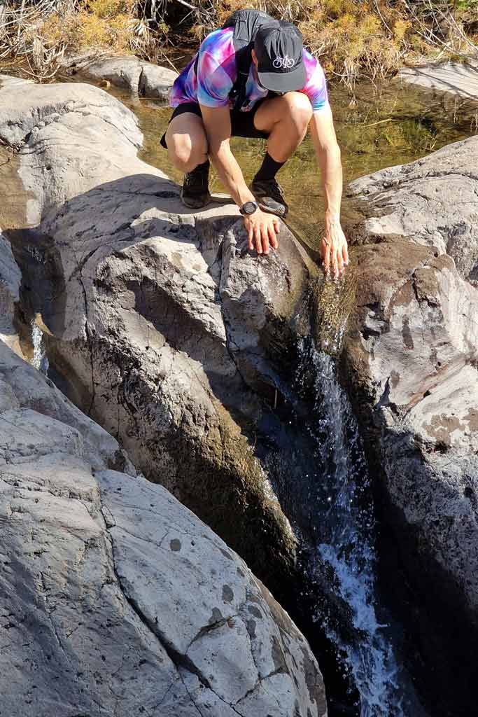
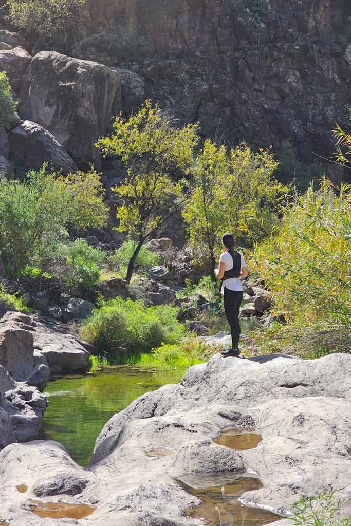
During the trail, You will skirt the entire Soria ravine until you reach its base. Un show from start to finish, both for the views from above, and for the beauty of the ravine once at the lowest point.
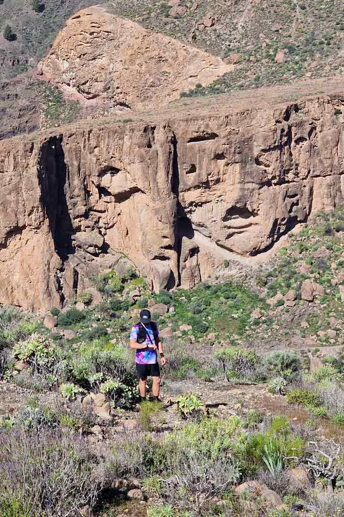
Once down, the climb begins again to the Las Niñas dam. We recommend that you pay attention to the rocks along the trail, we some formations in the mountains reminded us of Egyptian ruins.
Once in Las Niñas, the descent towards the Soria dam begins again. skirting the other side of the ravine with incredible views. Finally, the route ends by ascending again to Chira, where we decided to start this circular.

Route characteristics and recommendations
Please note that this route de hiking in Gran Canaria It is of an advanced level, given its length of almost 18 kilometers and unevenness. more than 1.000 meters. It took us about 5 hours including a break we took to have a drink in the town of Soria. Likewise, we made quite a few stops to record the route, but in We were trotting on the plains. Undoubtedly, If you like trail running, it is an ideal trail to practice this sport. Below we leave you all the technical details.
| Distance | 17,5 Km |
| Approximate duration (walking/running) | 4-7 horas |
| Total promotion | 1.237m |
| Level | Advanced |
| Circular | Yes |
| Provisioning | Yes, but at Km 10 |
On the other hand, regarding the weather, we did it in February 2023 with short sleeves, but it depends on the prediction. Usually, During the cooler months we recommend bringing some warm clothing. In summer it may be a very hot and less attractive route due to the lack of water. Remember to bring suitable footwear, enough water and food.

Keep in mind that this area is quite arid due to its proximity to the south (it doesn't rain much) and, even so, We found plenty of water and some small waterfalls. However, both Las Niñas and Soria had very little water reserves. Likewise, as we show in the video, There are about 50 meters during the descent to the Soria ravine that the path is not very cleansed. If you follow the track you will not lose.
Track of the Three Dams route in Gran Canaria
Currently, Part of this route is closed, since the Mogán city council does not allow passage through the Soria dam (they are under construction). We will notify you when it is operational again. However, you can then download the track of this Las Presas route in .gpx format so you can follow it on your own without getting lost. If you don't know how to download it and follow it from your GPS-watch or smartphone with the Guru Maps app, here we explain it to you. The best way to support us so that we continue creating content about Gran Canaria for you is by purchasing one of our tracks, either to enjoy incredible routes or as a donation. Oh, and don't miss the video we have prepared for you below!

Where to eat on the route
Keep in mind that along the dam route you will only be able to stop to eat or buy snacks next to the Soria dam (approximately kilometer 10). We took a break right here and took a natural papaya and mango juice at the Casa Fernando restaurant. Since we did the walking-running route, we didn't want to eat anything heavy. If you are going to do it on foot, you can Stop to eat here or buy food in some of the supermarkets in the area. They are even open on Sundays.

Keep in mind that once you arrive in Soria, A climb of about 500 meters awaits you, so even if you are walking, it is better not to eat too much. On the other hand, we don't know how the food is here, but it looked good.
Video: route of the Gran Canaria Dams
Below you can see the full video of this hiking route, a video is worth a thousand words! Subscribe to our YouTube Channel y Activate the bell to find out about new videos about plans to do in Gran Canaria.
Gran Canaria Guides
Lastly, if you want to know more about what to see in Gran Canaria and where to eat, on this page you have infinite content available. If you prefer not to waste your time looking for information here and there, in our guides you will find all our recommendations for things to do and restaurants. You can see them all below.


We are Ruth & Jorge, Gran Canarian people with a traveling soul. Experts in tourism and digital marketing. We share the most authentic side of Gran Canaria (where we live) and… our adventures around the world!

Fantastic.
THANK YOU
You are welcome!!! We are glad you like it 🙂