
El Natural Park of Tamadaba is one of the most important protected areas in Gran Canaria known for having one of the best preserved canary pine forests de Canary Islands. Likewise, you should know that tamadaba houses most of the area of the Cultural Landscape of Risco Caído and the Sacred Mountains of Gran Canaria, UNESCO World Heritage named in 2019. The park occupies a surface of more than 7.500 hectares in the northwest of the island, within the municipalities of Artenara, The Village of San Nicolás y Agaete. Next, we share all the information about this park and At the end we share a trail so you can visit it on your own.
Tamadaba Natural Park, Gran Canaria
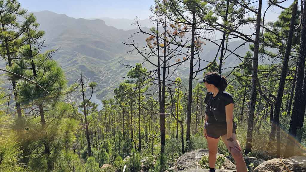
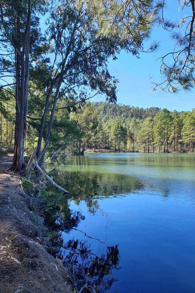
Tamadaba Natural Park is one of the largest virgin areas on the island and, given its characteristics, it is also a Biosphere Reserve. In this environment The Canary Island pine reigns among many other plant and animal species, some endemic to the island such as the blue finch.. Did you know that Canary Island pine is fire resistant? Thanks to the thickness of its bark, The Tamadaba pine forest in Gran Canaria has survived several fires. You yourself can see the shoots emerge from the trees that survived the 2019 fire that affected 32% of the park . In the interior Tamadaba park there are also private hydraulic works and Cortijo de Samsó dam.
As you can see, it is a beautiful environment after the rains and one that we were lucky enough to visit. If I'm not mistaken, it is now prohibited to travel through here.
Places to visit and information of interest
On the other hand, you must keep in mind that given the extension there are many places what to see in Tamadaba. This special protection area extends to the coast of La Aldea de San Nicolás where we highlight the Andén Verde or Balcony Viewpoint. Another special place in Tamadaba is the Roque or Risco Pout (7th highest coastal cliff in the world at 1.027 m). We also highlight some beaches such as Guayedra, Phaneroque y The risk, all in Agaete. Finally, the highest point of Tamadaba is the La Bandera Peak with 1.444 meters of altitude. In fact, the Canary Island pine likes heights and we find it between 400 m and up to 2.000 m as in other mountainous Canary Islands.

Camping Tamadaba, camping area of Llanos de la Mimbre
Tamadaba and its natural park is one of the places alloweda hacer camping in Gran Canaria. Called La Mimbre Plains, just like the spectacular viewpoint that is just a few steps away and that we will tell you about below. It has surveillance, bathrooms and drinking water. Here you can camp both with a shed and with caravans or campers. Please note that the capacity maximum is 200 people and you must request prior authorization from the Cabildo of Gran Canaria here. La Tamadaba camping area does not have barbecues, but the recreational area that we share with you later does.
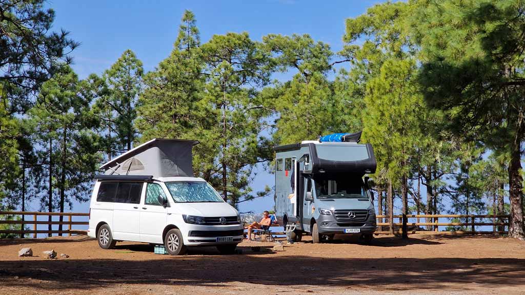
Important: during the summer months you have to be very attentive to fire alerts, since it is a difficult evacuation area and, therefore, camping is prohibited during these.
Llanos de la Mimbre Viewpoint
Another of the Places to see in the Tamadaba Natural Park are the Llanos de La Mimbre Viewpoint. It is only about 5-10 minutes walk from the camping area. From here you will have some views spectacular views to the coast of Puerto de Las Nieves, Tenerife and The Village of San Nicolás. Next to the Mirador del Balcón, it is one of the Gran Canaria viewpoints more impressive.

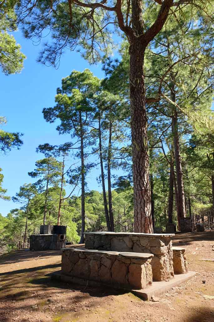
Tamadaba Recreation Area
In full Tamadaba Natural Park You can also enjoy one of the recreational areas of Gran Canaria more special. It has picnic tables and a barbecue area under the shade of imposing Canarian pines.. In addition, it has public toilets, drinking water and parking area. To use this recreational area no need to ask permission. Of course, as we mentioned before, you must pay attention to the fire traffic lights to know if you can access this recreational area, since the access road is also closed. The Fire season is usually from July 1 to September 30.
- ⏰ Hours: from 9:00 a.m. to 19:00 p.m. (until 18:XNUMX p.m. in winter).
Hiking in the Tamadaba Natural Park: routes and tracks
El Tamadaba Natural Park is one of essential places to do hiking in Gran Canaria. Therefore, below, we share with you a route through Tamadaba that starts from the Tamadaba recreational area. where then You can stay to spend the day using the picnic areas. Also We have recorded the track so that it also passes through the popular Llanos de La Mimbre viewpoint so that you don't miss its vertigo views. Before we had another route published, but It passed through the dam and other private roads that we have already eliminated. We share the details of the new one:
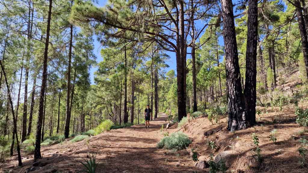
In addition to the viewpoint, during the route you will have views of the Roque Faneque, Roque Nublo, Roque Bentayga and Lugarejos and Los Pérez dams. Below we share the summary table with the technical characteristics of the route so that you can assess if you can complete it depending on your physical fitness. We did it running on the plains and it took us about two hours. Please note that the slopes and trails are closed during the fire alert due to the difficulty of evacuating the area.
| Distance | 10,3 km |
| Approximate duration | 2 -3 hours |
| Total promotion | 380m |
| Level | Intermediate |
| Circular | Yes |
| Picnic zone | Yes (start/end route) |
Download the Tamadaba walk track
You can then download the track of this circular hiking route through the Tamadaba Natural Park in .gpx format. If you don't know how to download it and follow it from your GPS watch so as not to get lost, there are numerous apps to follow tracks in .gpx format with your mobile phone such as Guru Maps. Here we explain it to you. If you want support us so that we continue creating content for you about Gran Canaria, we will greatly appreciate it if you purchase any of the tracks. We will be happy to help you enjoy incredible routes around our island. Oh, and don't miss the video we have prepared for you below!

Finally, although many believe it, it is not Tamadaba National Park, it is a natural park. For now this protected space does not have that distinction. Although as we told you before, yes it is UNESCO world heritage. Therefore, it is a essential to visit in Gran Canaria for nature lovers.
Video of the route through the Tamadaba natural park
Below we leave you with a video about the hiking route we did through Tamadaba, subscribe to our YouTube channel so you don't miss any more videos from Gran Canaria.
Gran Canaria Guides
We hope you liked this brief tour of one of the most important natural spaces in Gran Canaria! If you want to discover more plans what to do in Gran Canaria, continue browsing here or jump straight to our digital guides to the island by clicking below.


We are Ruth & Jorge, Gran Canarian people with a traveling soul. Experts in tourism and digital marketing. We share the most authentic side of Gran Canaria (where we live) and… our adventures around the world!

Tamadaba in a magical and emblematic place in Gran Canaria. Thank God he was saved from the fire and is recovering the burned part.
Your report and your words highlight it: you do not preserve and you do not love what you do not know.
THANK YOU
Thank you very much José Antonio, as always. A hug
Good afternoon guys. Congratulations for the work you do and thank you very much for all the information. Could you confirm for me if there really are drinking water taps in the Tamabada recreational area? Thank you!
Very good Jorge, Thank you very much for your comment. The truth is that the sources we consulted to write the article confirm that it is drinking water, which is why we indicate it as such 🙂 If it were not drinkable, there should be informative signage indicating it.
Enjoy a lot!
Hi guys,
I love the website and the plans they offer. Thanks 🙂.
In this case I ask you to update the route (the track) because there are several areas that have posted the sign prohibiting access because it is a private area and the route remains in the middle. It happened to several groups that we agreed on several points.
A hug 🤗
Hello Alejandro!
Thank you for your comment and for letting us know!
We'll have to go and investigate again. I hope you could at least enjoy part of it :)
A hug