San Felipe is a coastal town that belongs to the municipality of Santa Maria de Guía, in the north of the island of Gran Canaria. Its coast is an attraction for the most daring local surfers, since it is an area with strong waves. Likewise, it stands out for its tradition for the cultivation of banana trees, which gives it a special ethnographic and landscape value. Furthermore, in San Felipe It is where we can see and travel the best preserved section of the historic Camino Real del Norte. We are going to give you all the details below, stay with us!
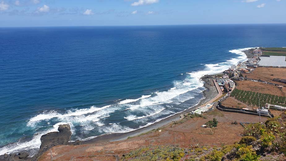
San Felipe, Gran Canaria
✔ San Felipe Beach or Vagabundo Beach
San Felipe beach, known locally as Vagabundo, is one of the few that the coast of the municipality of Santa María de Guía has. Here both the waves and the currents are very dangerous. Therefore, be very careful if you are a surf lover and decide to take a dip in one of the best beaches to do. surfing in Gran Canaria. At the same time, you should know that the beach is made of pebbles or callaos as we call it in the Canary Islands. When the tide goes out, some black sand remains.
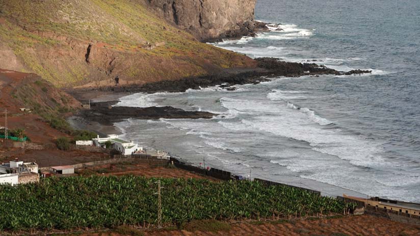
Likewise, just a few meters away by car we also have the well-known San Lorenzo Puddle in case you want to take a dip in the sea safely. One of the natural pools in Gran Canaria that you should know. The entire coast of this area in the north of the island of Gran Canaria is made of pebbles.
✔ Camino Real del Norte
Whether you are a hiking lover or not, you should know that In San Felipe you can walk part of the old Camino Real del Norte of Gran Canaria. Have you ever heard of the Camino Real del Norte or the Camino de San Felipe? This is the historic road that linked the municipalities of Santa María de Guía and Gáldar with Las Palmas de Gran Canaria. It is believed that this road dates back to Aboriginal times, but after the conquest of the island, it was improved and conditioned, becoming a Royal Road. The path descends along the coastal cliff until reaching San Felipe beach or Vagabond beach. from where you will have spectacular views.
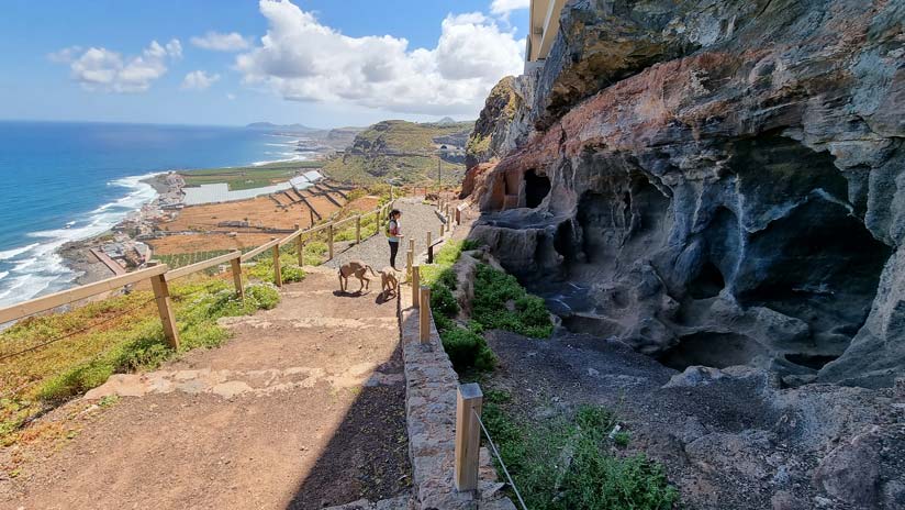
Next to the road We find a set of eight caves that served as homes and other uses in the mid-20th century.. These caves are known as Las Cuevas del Camino. It is believed that here those who kept the path lived and those who controlled the passage of travelers and merchandise. Also It was a point where health controls were established to prevent the spread of diseases such as yellow fever. back in the 19th century.
Extension of the Camino de San Felipe
As we said, the most preserved part of the Camino Real del Norte is found in San Felipe. It is a trail of about 2 kilometers with a gradient of approximately 500 meters. We took a circular route that ended this path by descending because we like to walk and discover the island. It is an extension of the Camino that passes through several rural areas in the interior of Guía. It also passes very close to the archaeological site of Cenobio de Valeron, built by the Canarian aborigines in order to use it as collective barn. Inside there are more than 300 cavities or silos that were formerly used for storing food and tools.
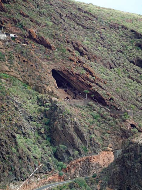
On the other hand, we will also go through the Galician Tagoror. It is a site made up of six cavities that apparently the noblest ancient Canarians used as seats in their socio-political meetings.
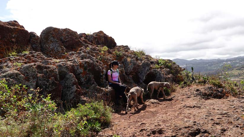
From El Tagoror of El Gallego we will have unique views of the mountain Gáldar or Guía mountain, as well as the entire northern coast of the island of Gran Canaria, even seeing the capital.
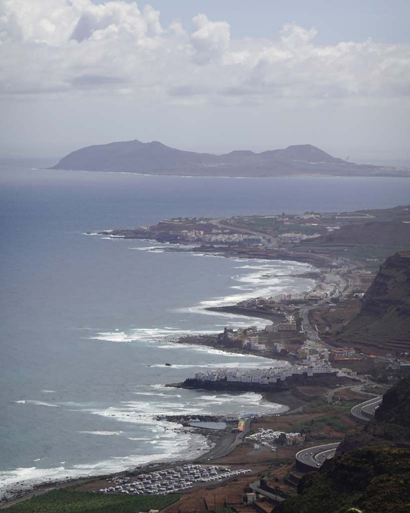
Features of the route extension
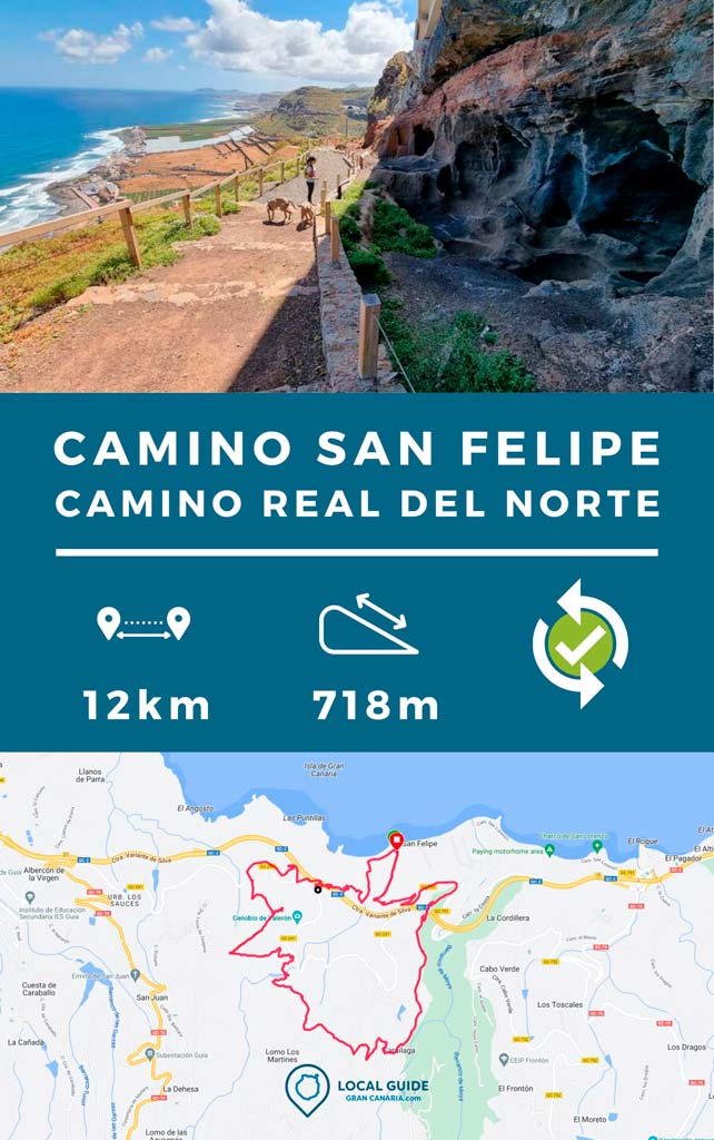
As we told you in the video at the end, the extension of the circular route has a high technical difficulty, since the passage in some areas is difficult and is not signposted. Likewise, at the beginning there is a section that you must do by road and another at the end that passes next to a tunnel on the northern highway (here it is signposted). We also do not recommend it for people with vertigo.. Furthermore, in many parts of the track we will pass through paths that are not very clear of undergrowth. Nevertheless, Both the views from the top where the Tagoror of El Gallego is located, and the final part of the Camino Real are well worth it. Below we give you the data of the circular route that we did.
| Distance | 12 km |
| Approximate duration | 5 hours |
| Total promotion | 718m |
| Level | Advanced |
| Circular | Yes |
| Picnic zone | No |
Track to do the route on your own
Then You can download the track of the circular route in .gpx format so you can follow it on your own without getting lost. If you don't know how to download it and follow it from your GPS-watch or smartphone with the Guru Maps app, here we explain it to you. If you want support us so that we continue creating content for you about Gran Canaria, we will be grateful if you purchase any of our tracks, either to enjoy incredible routes or as a donation.
Video of the extension of the Camino de San Felipe
Below you can see video of this circular route. Can Subscribe to our YouTube channel and activate the bell so you don't miss our videos here.
Gran Canaria Guides
If you want to know the most authentic side of Gran Canaria and not have to invest your time in what to see and where to eat, we invite you to take a look at our local guides to the island. Take a look below!
We are Ruth & Jorge, Gran Canarian people with a traveling soul. Experts in tourism and digital marketing. We share the most authentic side of Gran Canaria (where we live) and… our adventures around the world!


What wonders we have on the North coast of the Island of Gran Canaria.
Thank you very much for highlighting them.
We're glad you like it! All the best