
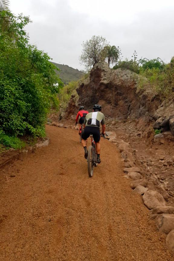
This bike route through the Guiniguada ravine is very well known among cyclists who live in Las Palmas de Gran Canaria. Although it passes through the bed of a ravine, the Cabildo de Gran Canaria has fixed it lately. Currently the road is quite wide, as well as flat. Thus, it is a wide dirt track perfect for Gravel Bikes, Mountain Bikes, electric bicycles or any type. The track is only suitable for bikes or hikers. Therefore, motorcycles or cars are not allowed.
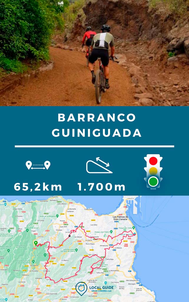
Bike route through the Guiniguada ravine
The path begins near the Stone bridge, in the zone of Triana. And today it extends practically to Santa Brígida, without having to go out onto the main road.
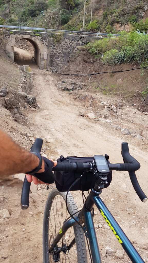
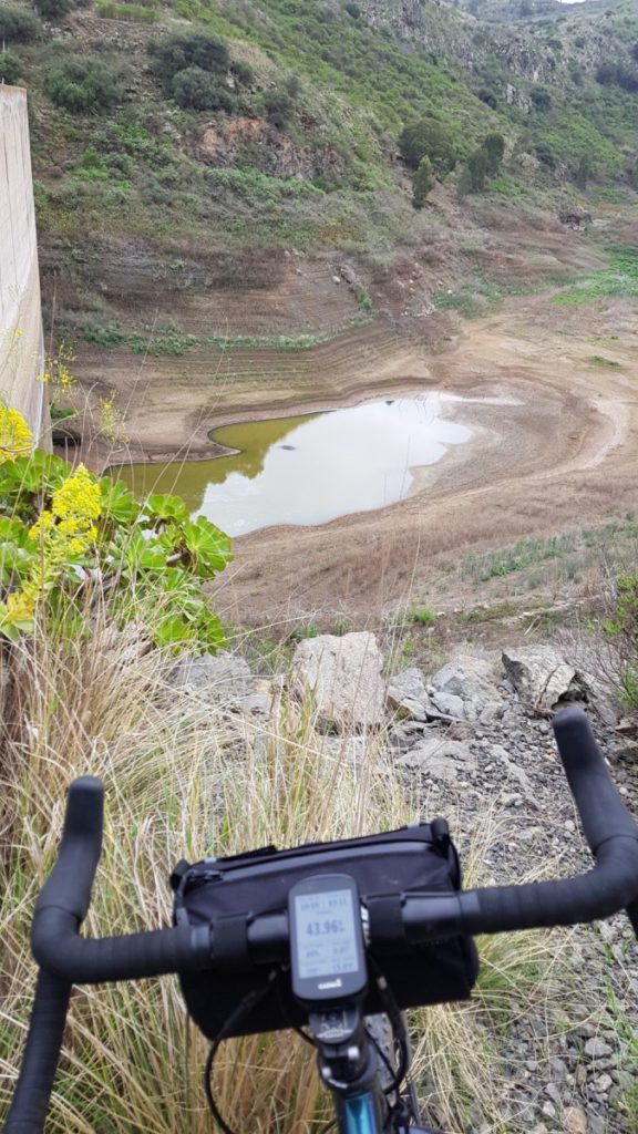
After climbing the entire Guiniguada ravine, we continued to the San Lorenzo area, where we went along some quite technical paths that surrounded The Painter's Dam.
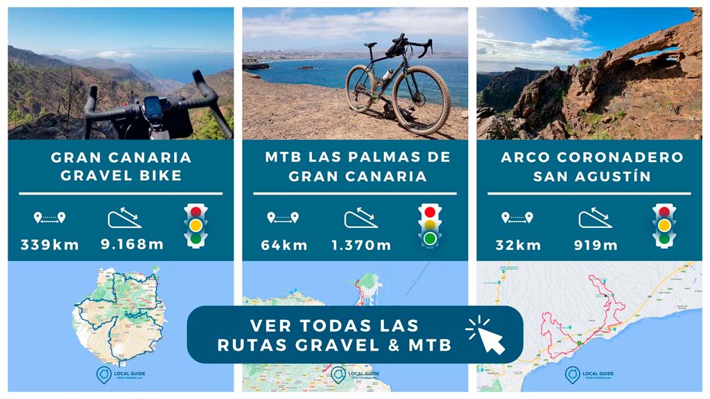
The track we show is from the circular Gravel Bike route, which passes through the following municipalities: Firgas, Arucas, Las Palmas de Gran Canaria y Teror.
Route characteristics
| Distance | 65,19 km |
| Total promotion | 1.709m |
| Estimated time | 5-6 horas |
| Minimum drink | 1,5 l |
| Minimal food | 600 Kcal |
| Shops on the road | Si |
| Technical level | Easy |
| Recommended bike | MTB/Gravel |
Track of the route through the Guiniguada by bike
Below you can Download the route track in .gpx format so you can follow it on your own without getting lost. If you don't know how to download it and follow it from your GPS or smartphone with Guru Maps, here we explain it to you. If you want to support us so that we continue creating content for you about Gran Canaria, we would appreciate it if you purchased any of our tracks, either to enjoy incredible routes or as a donation.
Finally, if you've been wanting more, take a look at all our MTB routes below.
Athlete and lover of life on two wheels, both mountain biking and urban biking. He is the Spanish MTB downhill champion and, therefore, a great connoisseur of the mountains of Gran Canaria.

Three friends have done several routes, the one to the airport, the one to Firgas and this one. All good but the part of the dam area on this route is more than technical, you have to carry the bike through an area that is difficult to access and over a large slope. It also penalized us that we were driving electric.
Otherwise, highly recommended routes, although I don't know how you do them with gravel 👌
Hello Jose! Thank you very much for your comment, we leave it here in case it is useful for other riders who ride electric, something that is complicated in that technical part when carrying. Let's keep pedaling around the island! A hug
Thank you very much for the reply. Soon I will have my Garmin Edge to do it.
regards
perfect Dramas! You tell me what's up! A hug
Hey.
I am interested in this route since I live nearby and I usually go out on the mtb.
In what format is it downloaded, in gpx?
Greetings and congratulations for the initiative.
Hello Doramas! Thank you very much for your comment 🙂
You can download it in .GPX, whose extension is valid for most GPS on the market such as Garmin, Polar, Wahoo... And if you don't want to follow it with your smartphone, you can use the guru maps app (Previously called Galileo) that will work perfectly for you. .
Greetings and thanks for reading.